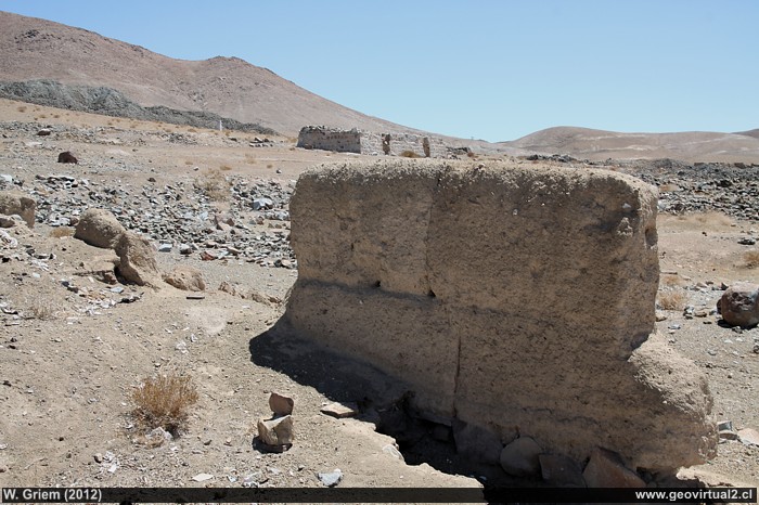
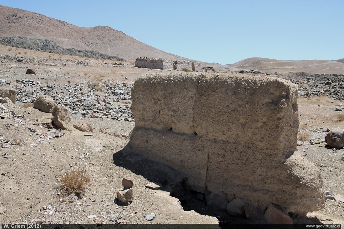
Photo: Adobe Walls and Houses in the Qda sector. Tres Puntas; November 2012 W. Griem (Ca50D6594) - Large Photo
Información Foto: Cámara Canon 50D: [IMG_6594.jpg]
Lente: 18-135mm | Longitud focal: 32mm (51,2/35mm) | Tiempo: 1:80 | ISO100
F: f/14 | Tamaño original: 4752 x 3168 | Fecha: 2012/11/02/12:05 hrs.
Tres Puntas
information:
• Tres Puntas
currently abandoned
23 inhabitants / miners (1952) (source: XII Census)
18 inhabitants (1930) (source: X. census)
61 inhabitants (1920) (source: Census 1920)
280 inhabitants (1895) (source: Visión Atacama, 1986)
398 inhabitants (1875) (source: Census 1875)
4000 inhabitants (1854)
• Chimberos
13 inhabitants (1920) (source: Census 1920)
385 inhabitants (1895) (source: Visión Atacama, 1986)
820 inhabitants (1875) (source: Census 1875)
Tres Puntas: p.1 │ p.2 │ p.3 │ p.4
History:
Probably the Incas knew Tres Puntas by its location near the Inca Trail
and some ancient work and ruins.
1792 Fermin Guerra probably finds mineralization but dies quickly. The
year 1848 is the official date of the discovery of Tres Puntas. During
the following years, a considerable amount of silver is mined from the narrow
veins.
Timeline of Tres Puntas
Location:
Tres Puntas is located between "Chimbero" and
Inca de Oro. The district
extends from the Buena Esperanza
mine to "Al Fin Hallada".
Perhaps there is a discussion of two districts: Chimbero and Tres Puntas, possibly under Tres Puntas..
Today bordering the Inca de Oro mining sector (Au).
There are some old roads in good condition. Unfortunately, many nails and other objects are found in the streets, puncturing the car tires.
Also, there is a vast amount of
vinchucas throughout the sector
Tres Puntas is located between "Chimbero" and Inca de Oro. The district extends from the Buena Esperanza mine to "Al Fin Hallada."
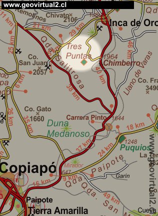
Location chart of the Tres Puntas mines in Atacama.
Mining Atacama
Journey to Atacama
Mining and Mines
List
of mine districts
Mining
between 1830-1920
Chañarcillo
Tres Puntas
►
Pueblo de Tres Puntas
Cemetery of Tres Puntas
Buena Esperanza
mine
Mina Cobriza
Cronología de Tres Puntas
Historical records
Treutler, living in Tres Puntas
Treutler:
Salvadora mine
Philippi en Tres Puntas
más Tres Puntas
Cerro Blanco
district
Lomas Bayas
Agua Amarga
Distrito Inca de Oro
Puquios - Carrera Pinto
Carrizal Alto
Checo de Cobre
More mining districts ...
Area Tres
Puntas
Estación FFCC Chimbero
Inca de Oro
village
Carrera Pinto
(ruins)
Distrito Inca de Oro
Ruta Copiapó - Diego de Almagro
Information
Atacama
History
of Atacama
Cronología de la Región
Mining history of Atacama
Railroad history of Atacama
Cartas y Mapas de Atacama
Cartas históricas de Atacama
Listado personajes de Atacama

