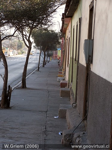
Photo: Typical street in Tierra Amarilla; Atacama Region - Chile. (W. Griem, 2006; Kodak9616) Large Photo
Photo Information:
Camera Kodak DX6490 | Focal length: 19,4mm | Shutter speed:
1:125
F: f/4 | Original size: 2304 x 1728 | Date: 2006/06/28/9:19 hrs.
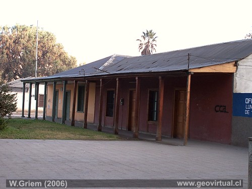
Photo: Houses at Tierra Amarilla; Atacama Region - Chile. (W. Griem, 2006; Kodak9581) Large Photo
Photo Information:
Camera Kodak DX6490 | Focal length: 11,1mm | Shutter speed:
1:125
F: f/3.2 | Original size: 2304 x 1728 | Date: 2006/06/28/8:56 hrs.
Tierra Amarilla: p.1 | p.2 | p.3 | p.4
The typical streets of Tierra Amarilla are reminiscent
of the different eras of the past. Mining cycles are also noticeable:
The number of abandoned houses in the midst of a booming mining boom
speaks for itself.
We must also mention the problems of the sector:
Today it is not so necessary that the engineer or worker lives in the
vicinity of his or her workplace. For Tierra Amarilla it means that many
families have already moved to Copiapó and a certain abandonment is
noticeable - especially if metal prices are low and the labor supply
remains a little unstable. In Tierra Amarilla, mining activity is
experiencing a strong pace, which depends for a large part on the
international price of copper. Also the mobility that is now required of
employees unfortunately does not favour small cities: A person who comes
for a few years project prefers the larger city.
A good step forward is diversification: agriculture (table grapes) or
tourism. A big push is currently being seen (2006) in Tierra Amarilla:
The very favorable prices of copper, iron, silver and gold have already
caused a certain economic reactivation..
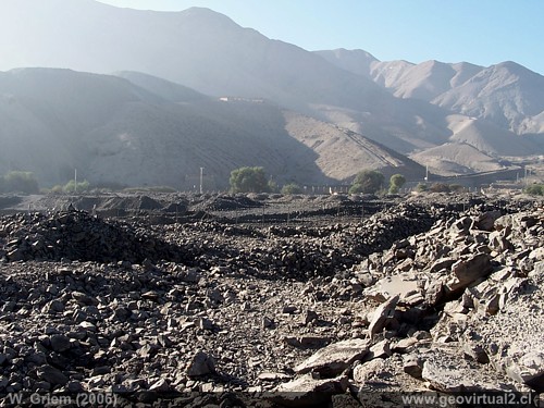
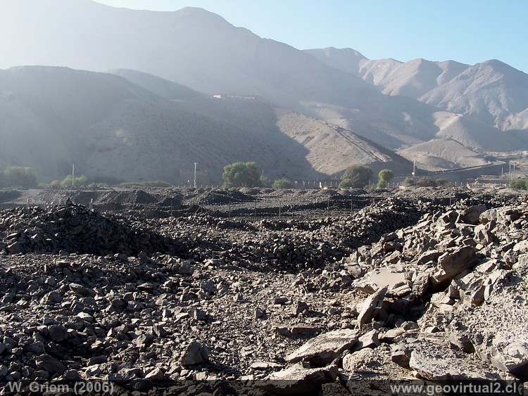
Photo: Slag from the historic foundries of Tierra Amarilla; Atacama Region - Chile. (W. Griem, 2006; Kodak9647) - Large Photo
Photo Information:
Camera Kodak DX6490 | Focal length: 6,3mm | Shutter speed:
1:90
F: f/7.1 | Original size: 2304 x 1728 | Date: 2006/06/28/9:59 hrs.
Places of interest
Information about Atacama
Intro valle Río Copiapó
Copiapó (Km 0,0)
►Tierra
Amarilla (km 15,7)
Nantoco (Km 22,2)
Sector Nantoco
The Copiapó river
-
a Cerro Blanco
Punta Brava (Km 53,7)
Los Loros (Km 62,3)
San Antonio (Km 70,1)
Smelter Inka (Km 74,0)
Aqueduct
Amolanas (Km 82,2)
Reservoir Lautaro (Km 84,2)
Iglesia Colorada (Km 110,1)
Río Montosa (Km 115,4)
Junta de Potros (Km 118,9)
La Semilla
Pastos Grandes (Km 137,1)
Qda. Pircas Coloradas (146,1)
Port. Cachitos (Km 167,1)
Río Turbio (Km 194,5)
Area
FFCC Copiapó - San Antonio
Atacama en b/n Tierra Amarilla
Qda. Carrizalillo
Valle Copiapó abajo
Mapa del sector
Sector en 3D
Related pages
GILLISS excursion Come Caballo
The Andes mountains
Atacama desert
History
of Atacama
Mining history of Atacama
Pages of interest
The railroad history of Atacama
Mining history of Atacama
History
of Atacama
Virtual vantage point to the Desert
Vida Atacama en b/n

