
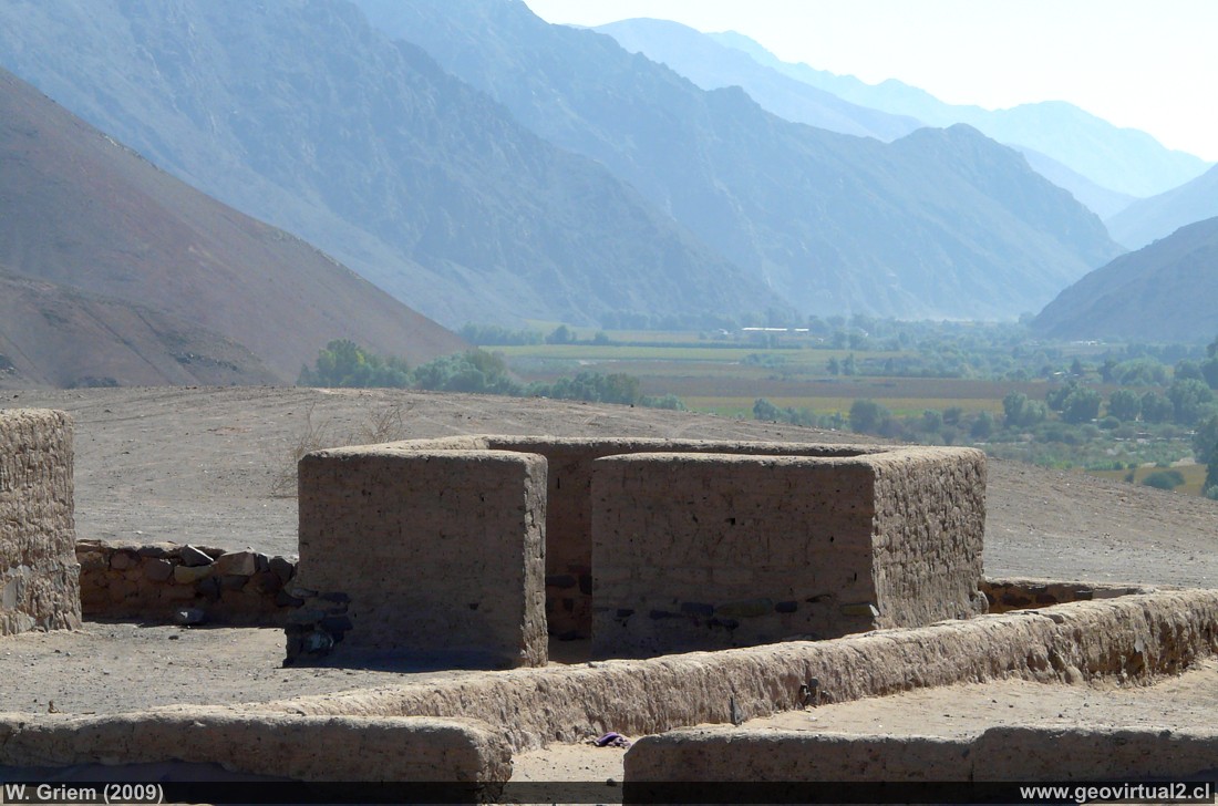
Photo: Residential house in the Inca foundry "Viña
del Cerro"; Region of Atacama - Chile. Photo: W. Griem (2009,
Panasonic8238)
Large Photo
Information Photo:
Camera Panasonic DMC-FZ18 | Focal length: 28.8mm
| Shutter speed: 1:200 | ISO100
F: f/8 | Original size (px): 3264 x 2448 | Date: 2009/05/01/14:22hrs.
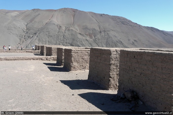
Photo: Residential houses of the Inca foundry "Viña
del Cerro"; Region of Atacama - Chile. Foto: W. Griem (2009,
Panasonic8226)
Large Photo
Information Photo:
Camera Panasonic DMC-FZ18 | Focal length: 4.6mm
| Shutter speed: 1:160 | ISO100
F: f/8 | Original size (px): 3264 x 2448 | Date: 2009/05/01/14:13hrs.
Historical smelter: p. 1 | p. 2
Inca foundry from the 15th century. This archaeological
site shows the mining and metallurgical activities of the Diaguita-Inca
culture.
The houses, administrative buildings and the remains of the ovens can be
observed in a well restored form.
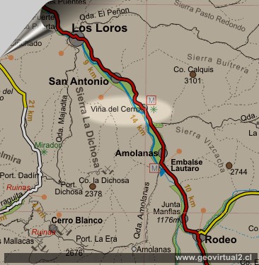
Informative Chart:
Viña del Cerro
Location data:
UTM: E398.698 / N69.13.589
Altitude: 1085 m
Distance to Copiapó: 74,0 km
Places of interest
Information about Atacama

Intro valle Río Copiapó
Copiapó (Km 0,0)
Tierra Amarilla (km 15,7)
Nantoco (Km 22,2)
Sector Nantoco
The Copiapó river
-
a Cerro Blanco
Punta Brava (Km 53,7)
Los Loros (Km 62,3)
San Antonio (Km 70,1)
►
Smelter
Inka (Km 74,0)
Aqueduct
Amolanas (Km 82,2)
Lautaro
reservoir (Km 84,2)
Iglesia Colorada (Km 110,1)
Río Montosa (Km 115,4)
Junta de Potros (Km 118,9)
La Semilla
Pastos Grandes (Km 137,1)
Qda. Pircas Coloradas (146,1)
Port. Cachitos (Km 167,1)
Río Turbio (Km 194,5)
Domeyko: Excursión al valle del río Copiapó 1843
GILLISS excursion Come Caballo
Area Around
FFCC Copiapó - San Antonio
Mapa del sector
Sector en 3D
Qda. Carrizalillo
Valle Copiapó abajo
Related pages
Mining history of Atacama
Roads of Atacama
Distances between ....
Road
maps
Mining history of Atacama
Tourist
information
Atacama
Travel instructions
Behavior in the desert
Specific terms
The Andes mountains
Atacama desert

