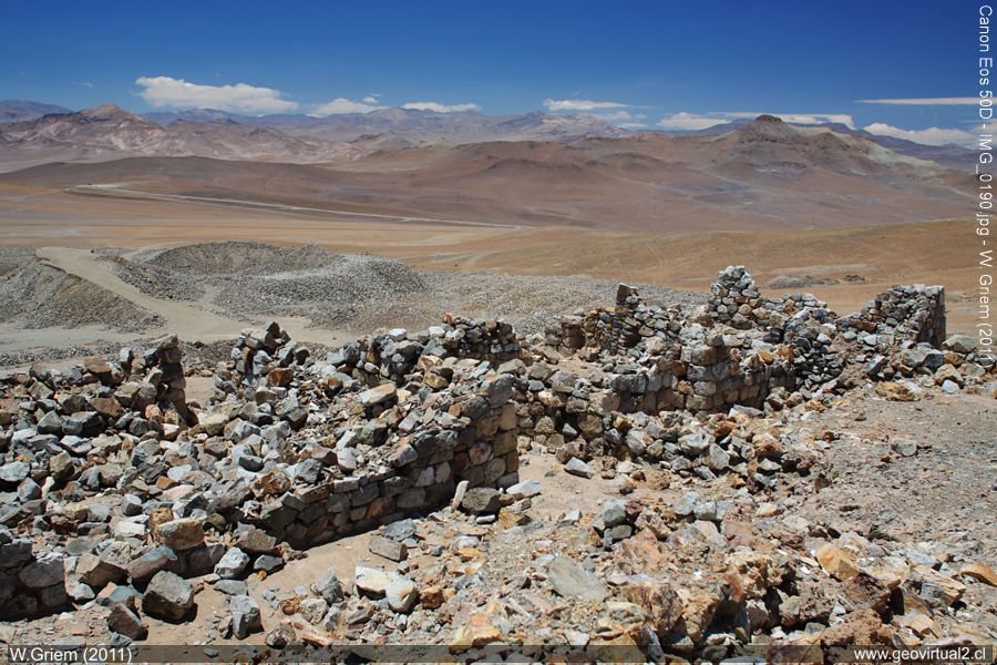
Photo: The Buena Esperanza Mine is still recognized for its extensive
ruins and labors. (November 2011 W. Griem;
Ca50D10190).
Large Photo
Información Foto: Cámara Canon 50D: [IMG_0190.jpg]
Lente: 20mm | Longitud focal: 20mm (32,2/35mm) | Tiempo: 1:160 | ISO100
F: f/6,3 | Tamaño original: 4752 x 3168 | Fecha: 2011/10/31/13:12 hrs.
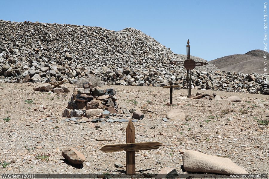
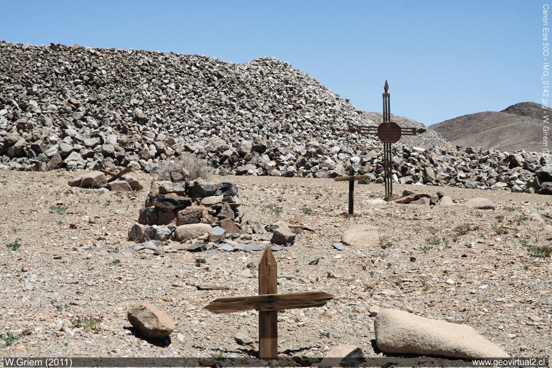
Photo: The small cemetery of the Buena Esperanza Ex-mine (Atacama Region) has almost collapsed under the rocks of the old stockpiles . Photo W. Griem, 2011 - Ca50D10142 - Large Photo
Información Foto: Cámara Canon 50D: [IMG_0142.jpg]
Lente: 17-70mm | Longitud focal: 62mm (98,8/35mm) | Tiempo: 1:160 | ISO100
F: f/13 | Tamaño original: 4752 x 3168 | Fecha: 2011/10/31/12:42 hrs.
Buena Esperanza: p.1 | p.2 | p.3 |Hist. | Data
The former silver mine "Buena Esperanza" ("Good Hope"),
located in the southern part of the district of
Tres Puntas, near the former railway station "Chimbero."
It was by far the largest mine in this area. The historical production
data confirm an impressive mining rhythm. Between 1860 and 1870, the
Buena Esperanza produced almost 80% of fine silver in the Tres
Puntas/Chimberro sector. In 1869 and 1876, the mine produced even more
fine silver than the many mines of Chañarcillo in the same period.
The quantities of quarried rock and overburden were gigantic by the
standards of the time.
Even today, visitors can still admire a
large number of large stockpiles in this area. It should be mentioned
that this was an underground mine; the mostly English companies planned
a sophisticated mining plan with their mining engineers to exploit the
ramified and often quite deep aisle deposits optimally.
The
drawings of this system that have been preserved give a hint of its
economic importance. Even today, it is still possible to distinguish
between the different types of buildings in ruins — solid houses for
administration and machinery, light timber constructions for workers.
Mining Atacama
History of Atacama

Mining and Mines
List
of mine districts
Mining
between 1830-1920
Chañarcillo
Tres Puntas
Village of Tres Puntas
Cemetery of Tres Puntas
►
Mine of Buena Esperanza
Mina Cobriza
Cronología de Tres Puntas
Historical records
Treutler, living in Tres Puntas
Treutler:
Salvadora mine
Philippi en Tres Puntas
más Tres Puntas
Cerro Blanco
district
Lomas Bayas
Agua Amarga
Distrito Inca de Oro
Puquios - Carrera Pinto
Carrizal Alto
Checo de Cobre
More mining districts ...
Area Tres
Puntas
Station FFCC Chimbero
Inca de Oro
village
Carrera Pinto
(ruins)
Distrito Inca de Oro
Ruta Copiapó - Diego de Almagro
Information
Atacama
History
of Atacama
Timeline of the Region
Mining history of Atacama
Railroad history of Atacama
Maps of Atacama
Historic maps de Atacama
Persons of Atacama

