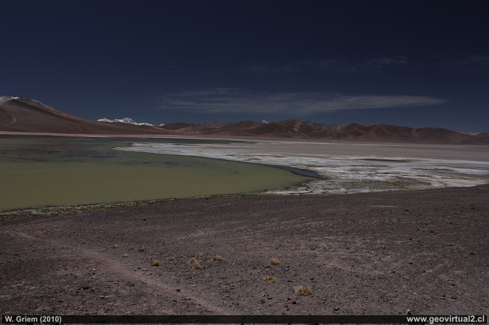
Photo: The Andes Mountains and the Laguna Negro Francisco Lagoon in the Atacama Region, Chile.. - Foto: W. Griem (2010; CaXSi9988) Foto en grande
Information Foto: Camera Canon XSi
Lens: 20mm +pol. | Focal length: 20mm (32,8/35mm)
| Time: 1:400 | ISO100
F: f/6.3 | Original size: 4272 x 2848 | Date:
2010/02/08/14:20hrs.
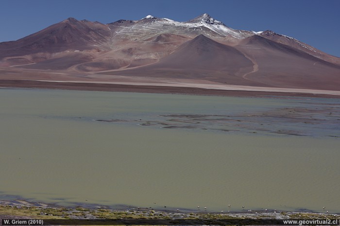
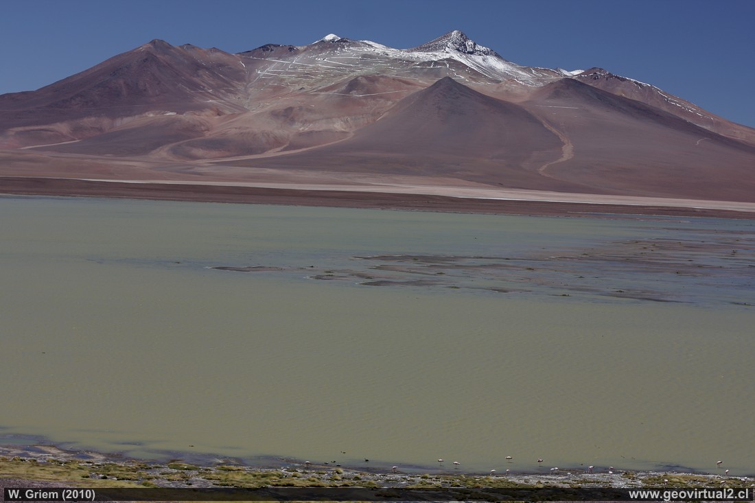
Photo: Negro Francisco Lagoon and Copiapó Volcano, Atacama Region - Chile. - Foto: W. Griem (2010; CaXSi9989) Foto en grande
Information Foto: Camera Canon XSi
Lens: 50mm +pol. | Focal length: 50mm (81,2/35mm) | Time: 1:200 | ISO100
F: f/6.3 | Original size: 4272 x 2848 | Date: 2010/02/08/14:21hrs.
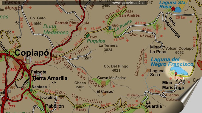
Lagoon Negro Francisco: p.1 | p.2
It must be taken into account that the Negro Francisco
Lagoon is located at a height of more than 4000 meters. This can cause
some discomfort in many people.
To reach lower levels is the fastest by the Mina Maricunga and Quebrada
Paredones, in about 57 kilometers the road is lowered to a height of
less than 3000 meters. The exit for Laguna Santa Rosa and Quebrada
Paipote remains some 107 kilometers over a height of 3000 meters.
There is always the possibility of bad weather in this sector, and
summer rains are not uncommon.
You can go down by Mina Maricunga / Quebrada Paredones or
Laguna Santa Rosa.
A summary of both paths can be found in:
a) Camino Internacional
- Laguna Negro Francisco
b) Intro Qda. Carrizalillo
- Laguna Negro Francisco
The fastest and safest access is via Quebrada Carrizalillo - Castaño -
Paredones. The detour through the portezuelo "El Gato" is more beautiful
- but it takes a long time.
Informative Chart:
Location information: Laguna Negro Francisco
Atacama Region
Province of Copiapó
Yellow Earth Commune
Distance from Copiapó: 195 km (per Carrizalillo)
Height: 4137 m (Laguna) / CONAF: 4168 m
UTM (CONAF): E474.554 / N69.59.678 (P. SA. 56)
Atacama virtual
Mining Atacama
Intro Carrizalillo - Laguna
El Maray (km 48,9)
Cabeza de Vaca (km 51,9)
Port. Castaño (km 90,8)
La Guardia (km 120,4)
Vega Colorada (Km 137,0)
Qda. Paredones (Km
154,4)
►
Lag. N. Francisco
(Km 194,7)
Intro Camino Internacional
Chulo (km 24,3)
Puquios (km 57,5)
La Baritina (km 67,7)
La Puerta (km 75,0)
Vegas Las Juntas
(km 123)
Port. Maricunga (km 140)
Lag. Santa Rosa (Km 147)
►
Lag. N. Francisco
(km 229)
*km desde Copiapó (Lider)
Nearby and more
Maricunga
salt flat
The Andes mountains
Atacama desert
Related pages
Roads of Atacama
Distances between ....
Road
maps
Mining history of Atacama
Tourist
information
Atacama
Travel instructions
Behavior in the desert
Specific terms
The Andes mountains
Atacama desert

