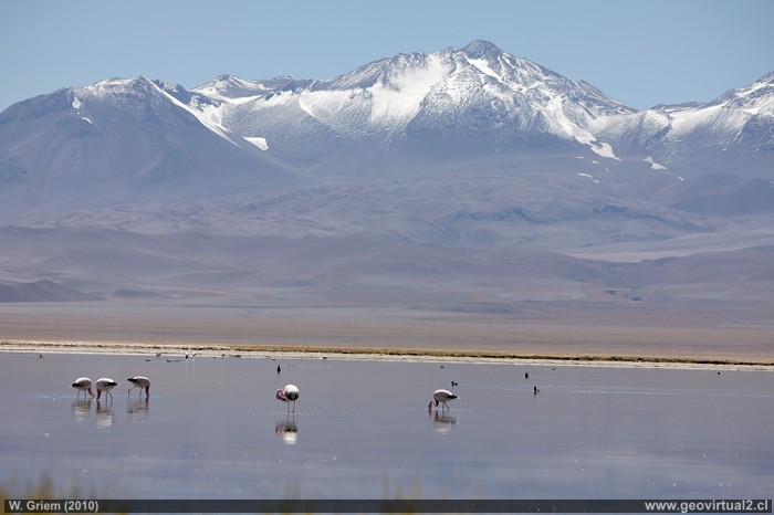
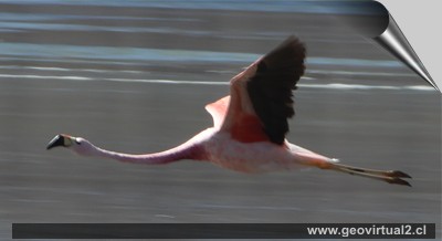
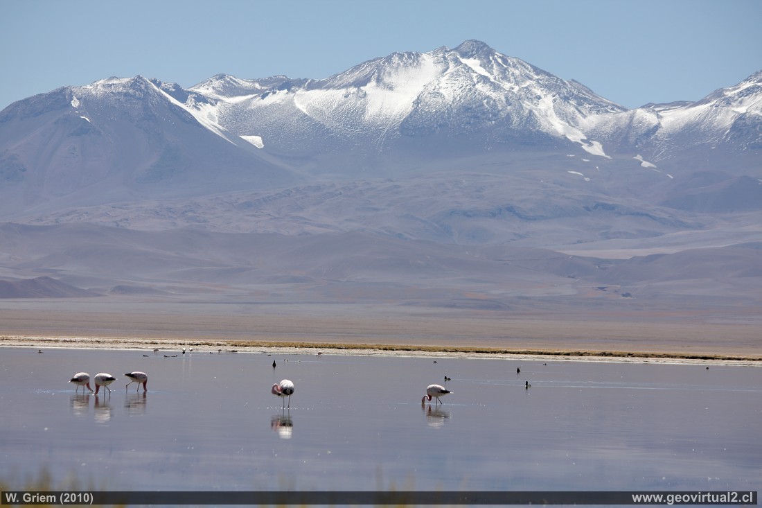
Foto: Flamingos in the Santa Rosa Lagoon; Atacama Region - Chile. (W.Griem, 2010; CaXSi9782) - Large photo
Photo Information:
Camera Canon XSi
Lens: 55-250mm | Focal length: 123mm | Time: 1:640 | ISO100
F: f/7.1 | Original size: 4272 x 2848 | Date:
2010/02/08/11:29hrs.
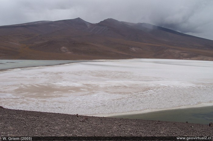
Photo: View from the CONAF viewpoint to Santa
Rosa Lake and Maricunga Salt Flat, Atacama Region - Chile. (W. Griem, 2005;
Kodak3960)
Large photo
Information Photo:
Camera Kodak DX6490
| Focal length: 6,3mm | Time: 1:250
F: f/7.1 | Original size: 2304 x 1728 | Date:
2005/02/18/16:05 hrs.
Atacama, Lake Santa Rosa: p.1 | p.2 | p.3
Especially the panoramic view of the Tres Cruces
Mountains with its height over 6700 meters gives a very particular
aspect to the Santa Rosa Lake. The distance to the top of Tres Cruces
mountain from La Laguna is more than 40 kilometers!
In the area of "Laguna Sta. Rosa", there's always the possibility of
poor wether. In the middle of summer a heavy rainfall is no exception.
---
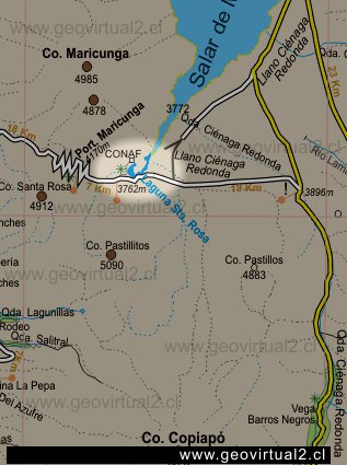
Places of interest
Information about Atacama
Intro Camino Internacional
Chulo (km 24,3)
Puquios (km 57,5)
La Baritina (km 67,7)
Empalme La Puerta (km 75,0)
La Puerta (km 81)
El Escorial (Km 86,4)
Vegas Las Juntas (km 123)
Port. Maricunga (km 140)
►
Lag. Santa Rosa
(Km 147)
Llano Ciénaga Red. (km 158)
Salar Maricunga
Cascada Río Lama
Ojos del Salado
Paso San Francisco
Qda. Ciénaga Red. (km 207)
Pantanillo (km 216)
Laguna N. Francisco (km 229)
Nearby and more
Maricunga
salt flat
Río Lama
The Andes mountains
Atacama desert
Related pages
Roads of Atacama
Distances between ....
Road
maps
Mining history of Atacama
Tourist
information
Atacama
Travel instructions
Behavior in the desert
Specific terms
The Andes mountains
Atacama desert
Other units
Atacama black and white
Virtual vantage point to the Desert
Collection of Books

