Atacama desert

www.geovirtual2.cl

Infinite plains of the Atacama Desert, Chile

Tololo Pampa, Atacama desert

Viewpoint Atacama

W. Griem, 2005 - 2021

Tololo Pampa, Atacama desert, Chile

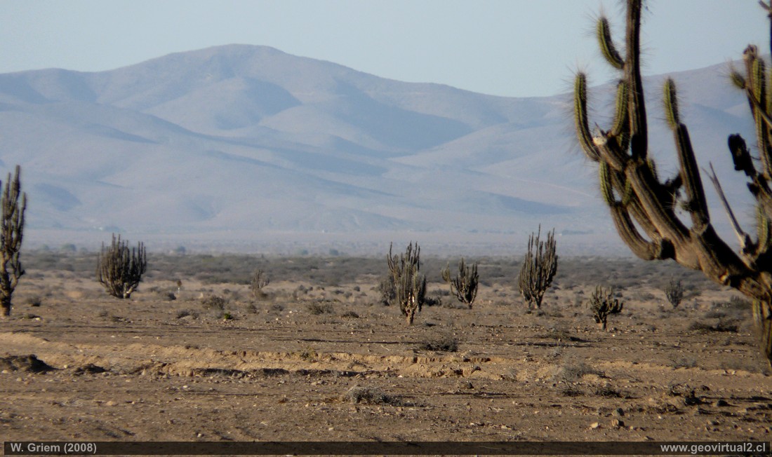
Photo: The extensive Pampa Tololo or Llano de la Jaula in the vicinity of Punta de Díaz and the Los Colorados mine (Fe). Nearby there are two historical runways: Tololo Pampa and Algarrobal. The plain stands out for its quantity of cactus candelabra and large quantities of guanacos. In summer the sector sets very high temperatures, according to its geographical location. The altitude of the plain is about 300 meters above sea level.
(Panasonic316; W. Griem 2008)

Description:
Location: Tololo Pampa, between Vallenar and Carrizal Bajo.
Nearest town: Vallenar (56 km)
Petrol: Vallenar (56 km)
Road condition: Salted - very good, last meters in desert roads - SUV, Jeep or Pickup
Worth seeing: landscape, flora, fauna, historical railway lines.
UTM: E316.632 / N68.80.300 - Height: 297 m.

Information Photo: Panasonic Camera DMC-FZ18
Focal length: 82.8mm (504/35mm) | Time: 1:400 | ISO100
F: f/4.2 | Original size (px): 3264 x 2448 | Date: 2008/01/12/19:47hrs.

Map of the Tololo Pampa area


Any new publication not authorized by the authors is expressly prohibited. This applies in particular to electronic publications:  Usage guidelines.

previous page of geovirtual, Atacama
Viewpoint content - Content Atacama Region
List of names and places of Atacama
next page in geovirtual, Atacama
line silver en www.geovirtual2.cl

www.geovirtual2.cl
Geology (Spanish)
Apuntes
Apuntes Geología General
Apuntes Geología Estructural
Apuntes Depósitos Minerales
Apuntes Exploraciones Mineras
Geological periods
Literature and Citation
Geological index (spanish)
Virtual museum
Virtual Museum: First page
Geological excursion
Some Minerals
History of Geosciences
Mining in historical literature
Fossils in historical literature
Historical authors mining and geology
Geological index (spanish)
---
Images of Chile and Atacama
---
The Coquimbo Region, Chile
The Coquimbo Region
History of the Coquimbo Region
Railroad history of Coquimbo
Names and places
---
Images from Chile
Atacama Region, Chile
Journey to Atacama
Atacama sightseeing places
History of Atacama
Mining history of Atacama
Geology of Atacama, Chile
The railroad history of Atacama
Flora Atacama
Animals of the Atacama Desert
Virtual viewpoint Atacama
Atacama en b/n
Road - maps /
Morphologic 3-dimensions
Climate history of Atacama
Books & Collection of Books
List of names and places of Atacama
sitemap - list of all files  - schematic content - Information site geovirtual.cl

www.geovirtual2.cl (english) / Virtual Museum / Atacama Region / Viewpoint Atacama
Virtual Museum of Atacama desert and Atacama Region, Chile
© Dr. Wolfgang Griem, Chile - all rights reserved  (Mail a Wolfgang Griem Uso de las páginas de geovirtual.cl y geovirtual2.cl)
Published: 18.11.2017, Updated: 18.11.2017, 27.02.2021
Mail a Wolfgang GriemMail and contact
Ver el perfil de Wolfgang Griem en LinkedInSee perfil Wolfgang Griem
All rights reserved
Any new publication not authorized by the authors is expressly prohibited. This applies in particular to electronic publications: Usage guidelines
© Wolfgang Griem (2005, 2009) - Todos los derechos reservados - alle Rechte vorbehalten - all rights reserved
valido W3C
validated 27.02.2021
HTML/5- R