Atacama desert

www.geovirtual2.cl

Infinite plains of the Atacama Desert, Chile

Road to Inca de Oro

Viewpoint Atacama

W. Griem, 2005 - 2021

Road to Inca de Oro, Atacama desert, Chile

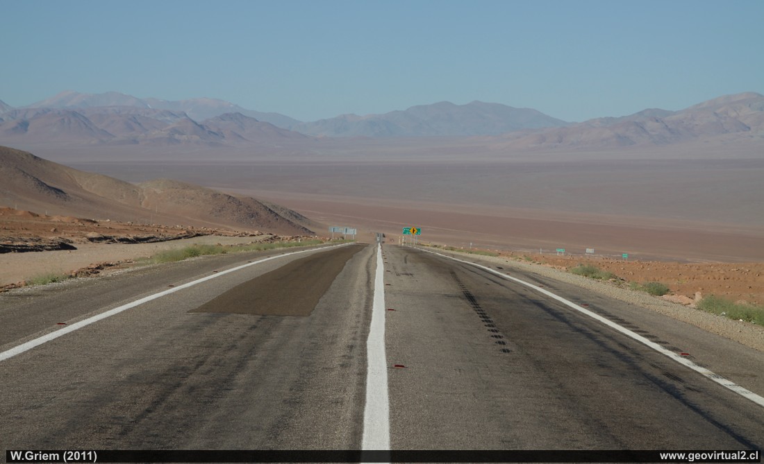
Photo: The road enters the vicinity of Carrera Pinto to the infinite Llano Varas. As there is no reference point the dimensions are completely lost.
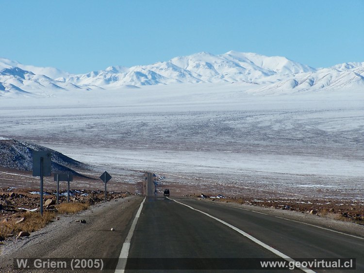
(Ca50D- 10566; W. Griem 2011) - see the same photo with snow
When you get to this point in your vehicle, you can well understand the grace of cars - or in the past railway time. The hills on the horizon (Sierra Fraga, Vicuña and El Pingo) are mining districts - in the fifties the miners walked from the mine to the Carrera Pinto station - crossing the plain about 20 kilometers wide. That was only possible in the early hours of the morning - to arrive with the first rays of sunshine near the station and thus avoiding a march in broad daylight where temperatures easily reach more than 50°C.

Description:
The rather lonely roads in the Atacama desert offer beautiful viewpoints. Especially the almost infinite vastness, the lack of a scale is hardly to be found in this way in other regions. The heat of the day can already become unpleasant, especially in the midday hours temperatures can be reached, which make a stay in the sun almost impossible.

Location: Carrera Pinto, road between Copiapó and Inca de Oro, Llano de Varas.
Nearest town: Copiapó (62 km) and Inca de Oro (38 km)
Petrol: Copiapó (62 km), Paipote (52 km)
Road condition: Asphalted, accessible to all vehicles
Worth seeing: landscape, desert, historic mining,.
UTM: E405.733 / N70.03.856 - Height: 1725 m.
Mine district Carrera Pinto - Puquios

Information Photo: Canon camera 50D
Lens 17-70mm | Focal length 70mm (111/35mm) | Time: 1:320 | ISO100
F: f/10 | Original size: 4752 x 3168 | Date: 2011/10/31/18:20 hrs.

map of the section Carrera Pinto


Any new publication not authorized by the authors is expressly prohibited. This applies in particular to electronic publications:  Usage guidelines.

previous page of geovirtual, Atacama
Viewpoint content - Content Atacama Region
List of names and places of Atacama
next page in geovirtual, Atacama
line silver en www.geovirtual2.cl

www.geovirtual2.cl
Geology (Spanish)
Apuntes
Apuntes Geología General
Apuntes Geología Estructural
Apuntes Depósitos Minerales
Apuntes Exploraciones Mineras
Geological periods
Literature and Citation
Geological index (spanish)
Virtual museum
Virtual Museum: First page
Geological excursion
Some Minerals
History of Geosciences
Mining in historical literature
Fossils in historical literature
Historical authors mining and geology
Geological index (spanish)
---
Images of Chile and Atacama
---
The Coquimbo Region, Chile
The Coquimbo Region
History of the Coquimbo Region
Railroad history of Coquimbo
Names and places
---
Images from Chile
Atacama Region, Chile
Journey to Atacama
Atacama sightseeing places
History of Atacama
Mining history of Atacama
Geology of Atacama, Chile
The railroad history of Atacama
Flora Atacama
Animals of the Atacama Desert
Virtual viewpoint Atacama
Atacama en b/n
Road - maps /
Morphologic 3-dimensions
Climate history of Atacama
Books & Collection of Books
List of names and places of Atacama
sitemap - list of all files  - schematic content - Information site geovirtual.cl

www.geovirtual2.cl (english) / Virtual Museum / Atacama Region / Viewpoint Atacama
Virtual Museum of Atacama desert and Atacama Region, Chile
© Dr. Wolfgang Griem, Chile - all rights reserved  (Mail a Wolfgang Griem Uso de las páginas de geovirtual.cl y geovirtual2.cl)
Published: 18.11.2017, Updated: 18.11.2017, 27.02.2021
Mail a Wolfgang GriemMail and contact
Ver el perfil de Wolfgang Griem en LinkedInSee perfil Wolfgang Griem
All rights reserved
Any new publication not authorized by the authors is expressly prohibited. This applies in particular to electronic publications: Usage guidelines
© Wolfgang Griem (2005, 2009) - Todos los derechos reservados - alle Rechte vorbehalten - all rights reserved
valido W3C
validated 27.02.2021
HTML/5- R