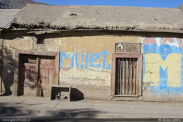
Photo: Old house in Los Loros, Atacama Region, Chile (CaPS- 1504; W. Griem 2003) Foto en grande
Photo Information:
Camera Canon Powershot-A100 (114-1504_IMG)
Focal length: 5,41mm (=44mm/35mm) | Time: 1:640
F: f/5.6 | Original size: 1280 x 960 | Date: 2003/11/07/17:04 hrs.

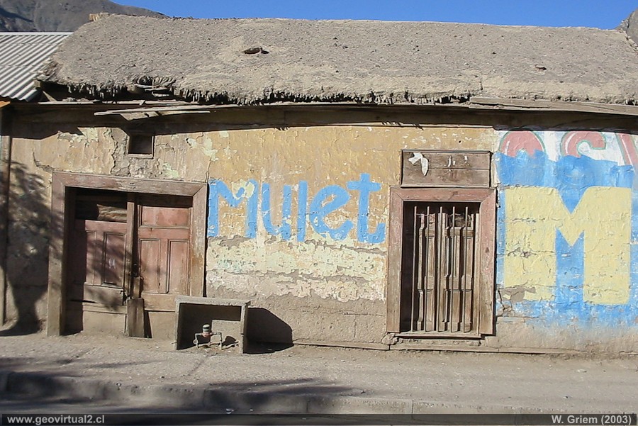
Photo: House in Los Loros, Atacama Region - Chile (CaPS1505; W.Griem, 2003) Large Photo
Information Photo:
Camera Canon Powershot-A100 (114-1505_IMG)
Focal length: 5,41mm (=44mm/35mm) | Time: 1:640
FF: f/5.6 | Original size: 1280 x 960 | Date: 2003/11/07/17:04 hrs.
For centuries the inhabitants of
Copiapó bought almost exclusively fruit and vegetables from this
sector.
The construction of the railroad to
Los Loros and San Antonio in 1855 gave a great boost to the mining
and agricultural industry of the sector. The journey to San Antonio,
unfortunately a few years after its inauguration, was lifted, the
journey to Los Loros remained in function until the seventies. Today,
only a few traces of the old railroad can be seen.
In 2012 a bypass was inaugurated, which allows not all traffic to enter
the village centre, especially the loading vehicles of mining projects
in the mountain range sector. Signs indicate that the work is a private
initiative of a mining company.
Informative
Chart:
Statistics of Los Loros (ranches and village):
1,075 inhabitants (1992) (source: INE)
261 inhabitants; (Village) (1952) (source: XII. census))
438 inhabitants (1930) (source: X. census)
437 inhabitants (1920) (source: Census 1920)
534 inhabitants (1895) (source: Visión Atacama, 1986)
550 inhabitants (1875) (source: Census 1875)
more statistics of the Atacama Region
The demographic development of Los Loros (or Loros) shows the same pattern of many villages in the Atacama Region: a strong development until 1895, a decrease in population with its peak in 1952, then until today a strong recovery in numbers of people. In the case of Los Loros, in 1952 the minimum number of inhabitants reached only 261 inhabitants (see above the statistical table in detail).
Places of interest
Information about Atacama

Intro valle Río Copiapó
Copiapó (Km 0,0)
Tierra Amarilla (km 15,7)
Nantoco (Km 22,2)
Sector Nantoco
The Copiapó river
-
a Cerro Blanco
Punta Brava (Km 53,7)
►
Los Loros
(Km 62,3)
San Antonio (Km 70,1)
Smelter Inka (Km 74,0)
Aqueduct
Amolanas (Km 82,2)
Reservoir Lautaro (Km 84,2)
Iglesia Colorada (Km 110,1)
Río Montosa (Km 115,4)
Junta de Potros (Km 118,9)
La Semilla
Pastos Grandes (Km 137,1)
Qda. Pircas Coloradas (146,1)
Port. Cachitos (Km 167,1)
Río Turbio (Km 194,5)
Del sector
FFCC Copiapó - San Antonio
Qda. Carrizalillo
Related pages
GILLISS excursion Come Caballo
The Andes mountains
Atacama desert
History
of Atacama
Mining history of Atacama
Pages of interes
The railroad history of Atacama
Mining history of Atacama
History
of Atacama
Virtual vantage point to the Desert
Vida Atacama en b/n

